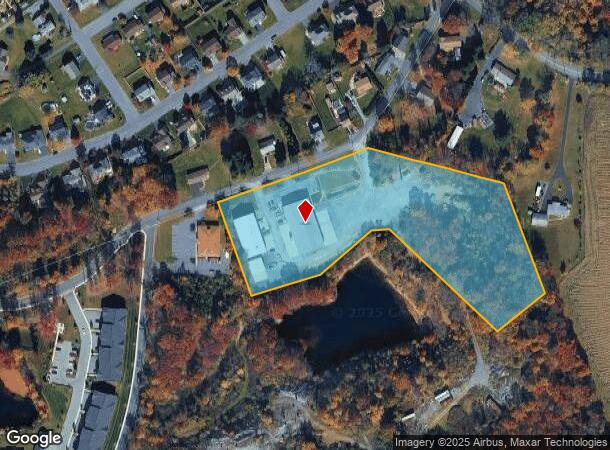
Property Record
543 E West St, Wind Gap, PA 18091

NEARBY LISTINGS FOR SALE OR LEASE
Property Detail
543 E West St
E8-21-1-0638-E
Preliminary Final Plan Plot Of Land To B
Manufacturinglight
Northampton
X
Pennsylvania
42095C0131E
6.35 AC
0
Lehigh Valley
2025
Philadelphia
015700
Allentown-Bethlehem-Easton, PA-NJ
13,176 SF
DEMOGRAPHICS near 543 E West St
1 Mile
3 Mile
5 Mile
2024 Total Population
3,608
11,575
30,730
2029 Population
3,612
11,631
30,896
Pop Growth 2024-2029
+ 0.11%
+ 0.48%
+ 0.54%
Average Age
45
44
43
2024 Total Households
1,585
4,716
12,242
HH Growth 2024-2029
(0.06%)
+ 0.49%
+ 0.65%
Median Household Inc
$54,530
$69,922
$73,881
Avg Household Size
2.20
2.40
2.50
2024 Avg HH Vehicles
2.00
2.00
2.00
Median Home Value
$236,538
$247,535
$248,809
Median Year Built
1965
1961
1964
Nearby Places
Map Layers
Map Styles
 Street
 Aerial
- Restaurants
- Banks
- Shops
- Fitness
- Groceries
PUBLIC TRANSPORTATION
AIRPORT
Lehigh Valley International
DRIVE
WALK
Distance
Lehigh Valley International
34 min
22.4 mi
Nearby Properties
Address
Land Use
TOTAL SIZE
Lot Size
Zoning
Address
Land Use
TOTAL SIZE
Lot Size
Zoning
430,352 SF
57.60 AC
GC/I
Address
Land Use
TOTAL SIZE
Lot Size
Zoning
13,872 SF
23.48 AC
IE
Address
Land Use
TOTAL SIZE
Lot Size
Zoning
352,026 SF
1.84 AC
GC/I
Address
Land Use
TOTAL SIZE
Lot Size
Zoning
349,517 SF
28.20 AC
HI
Address
Land Use
TOTAL SIZE
Lot Size
Zoning
42,140 SF
33.11 AC
R10
Address
Land Use
TOTAL SIZE
Lot Size
Zoning
324,240 SF
13.95 AC
HI
Address
Land Use
TOTAL SIZE
Lot Size
Zoning
214,540 SF
25.69 AC
GC/I
Address
Land Use
TOTAL SIZE
Lot Size
Zoning
12,355 SF
2,230.15 AC
E
Address
Land Use
TOTAL SIZE
Lot Size
Zoning
69,548 SF
9.18 AC
GC/I
Address
Land Use
TOTAL SIZE
Lot Size
Zoning
6,200 SF
345.07 AC
FF
Address
Land Use
TOTAL SIZE
Lot Size
Zoning
120,747 SF
22.45 AC
R12
Address
Land Use
TOTAL SIZE
Lot Size
Zoning
55,069 SF
6.77 AC
IC
Address
Land Use
TOTAL SIZE
Lot Size
Zoning
37,164 SF
2.73 AC
HI
Address
Land Use
TOTAL SIZE
Lot Size
Zoning
118,536 SF
14.36 AC
GCI
Address
Land Use
TOTAL SIZE
Lot Size
Zoning
7,704 SF
1.78 AC
R78
Address
Land Use
TOTAL SIZE
Lot Size
Zoning
48,084 SF
7.96 AC
RA
Address
Land Use
TOTAL SIZE
Lot Size
Zoning
34,781 SF
167.39 AC
FF
Address
Land Use
TOTAL SIZE
Lot Size
Zoning
3,440 SF
6.73 AC
IE
Address
Land Use
TOTAL SIZE
Lot Size
Zoning
1,050 SF
4.48 AC
PR
Address
Land Use
TOTAL SIZE
Lot Size
Zoning
20,608 SF
4.77 AC
R10
Address
Land Use
TOTAL SIZE
Lot Size
Zoning
5,106 SF
60.79 AC
RA
Address
Land Use
TOTAL SIZE
Lot Size
Zoning
18,710 SF
26.90 AC
GC
Address
Land Use
TOTAL SIZE
Lot Size
Zoning
50,000 SF
5.17 AC
1C
Address
Land Use
TOTAL SIZE
Lot Size
Zoning
118,536 SF
8.17 AC
GCI
Address
Land Use
TOTAL SIZE
Lot Size
Zoning
92,438 SF
19.14 AC
FF
Address
Land Use
TOTAL SIZE
Lot Size
Zoning
95,160 SF
14.33 AC
IC
Address
Land Use
TOTAL SIZE
Lot Size
Zoning
24,194 SF
2.25 AC
GC/I
Address
Land Use
TOTAL SIZE
Lot Size
Zoning
53,019 SF
3.82 AC
1C
Address
Land Use
TOTAL SIZE
Lot Size
Zoning
346.73 AC
RC
Address
Land Use
TOTAL SIZE
Lot Size
Zoning
5,024 SF
5.31 AC
GC
The World's #1 Commercial Real Estate Marketplace
Connect with us
© 2025 CoStar Group
The information above has been obtained from sources believed reliable. While we do not doubt its accuracy we have not verified it and make no guarantee, warranty or representation about it. It is your responsibility to independently confirm its accuracy and completeness. Any projections, opinions, assumptions, or estimates used are for example only and do not represent the current or future performance of the property. The value of this transaction to you depends on tax and other factors which should be evaluated by your tax, financial, and legal advisors. You and your advisors should conduct a careful, independent investigation of the property to determine to your satisfaction the suitability of the property for your needs.